Testing the capacity of the NSW LMR and Pattern Book Initiatives
The NSW Low to Mid-rise reforms (LMR) have been referred to as the most ambitious planning reforms in NSW in decades. But does the policy reflect the ambition? And, do the more recent and complimentary low-rise ‘patterns’ published in the NSW Pattern Book facilitate that intent?
A lot of numbers have been thrown around (both publicly and privately) with regard to how many dwellings these reforms might yield, but without an understanding or explanation with regard to how these calculations have been arrived at, it’s not really possible to understand the potential, capacity and viability of the these policies. A case study might provide some clearer insights.
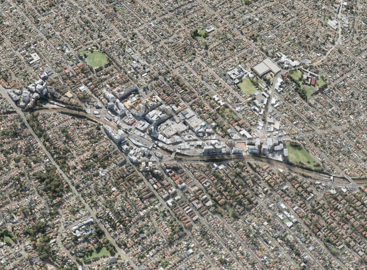
Aerial view of Hurstville
So here’s Hurstville (above); by all accounts a model candidate for these policy reforms. It is typical of many areas designated for LMR, sharing characteristics and development patterns common to well established middle ring suburbs. Typical to such suburbs, it has:
An established mixed-use centre straddling the railway station;
Good street layouts;
Good parks and riverine corridors for passive and active recreation;
A mature landscape and well established tree canopy - notably within the centre of the blocks and public parks;
Established mid-rise (typically earlier walk-up development);
Established mixed-use development primarily along roadways and transportation corridors;
Established TOD development surrounding the railway station.
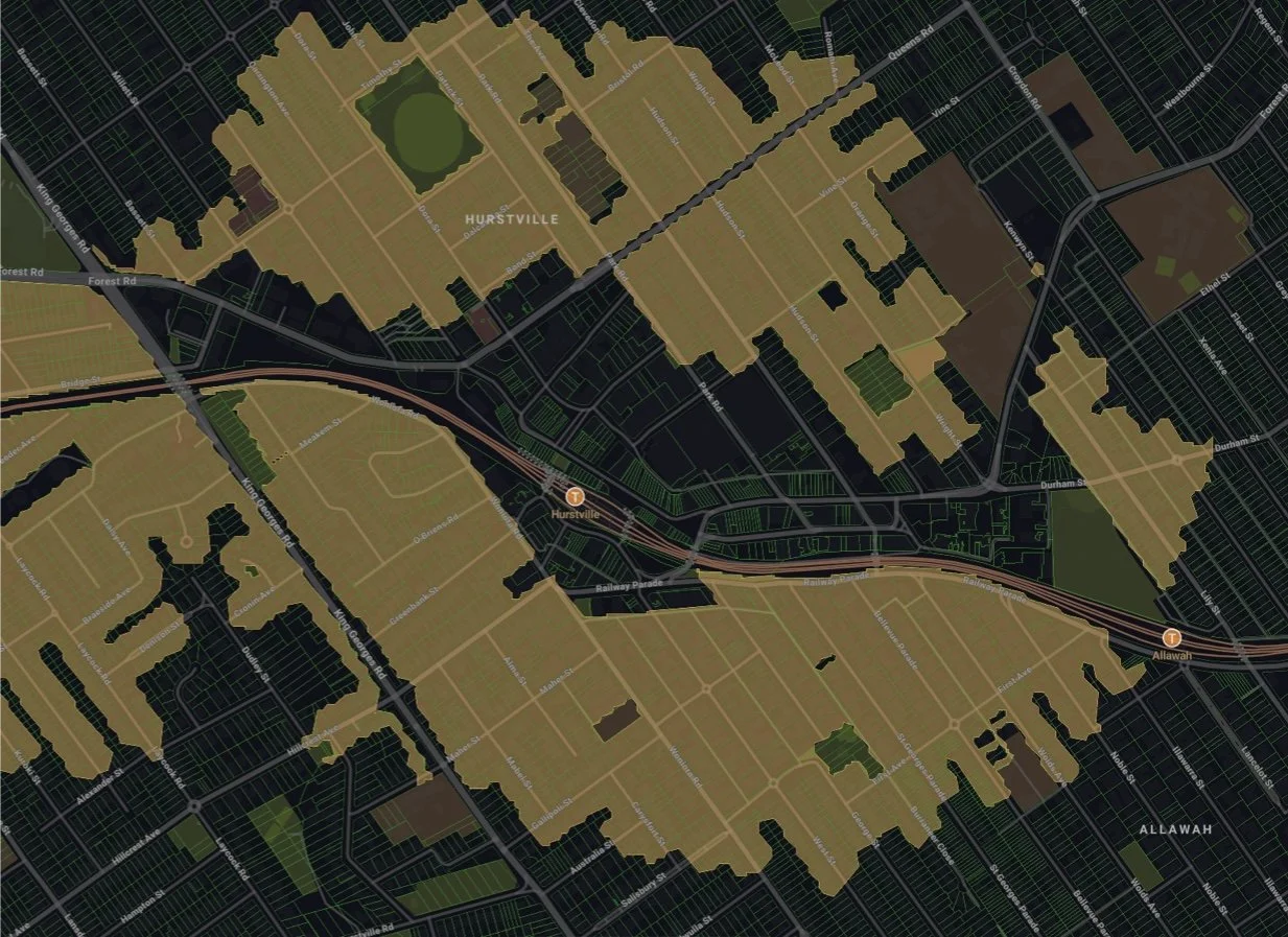
LMR Overlay (Mecone Mosaic)
Hurstville, like other similar centres straddling Sydney’s well serviced railway network, has been identified for uplift. Above, (extract from Mecone Mosaic) shows the extent of the area designated for the Low to Mid-rise (LMR) reforms - up to 800m walking distance from the railway station. The centre is carved out for denser TOD development, and the area is asymmetrical and irregular as it is defined not ‘as the crow flies’ but by ‘walkable’ routes from designated stations; that need to be verified by survey!
Independently of local LEP provisions, the NSW state based LMR provisions permit three scales of development within these shaded zones;
Low-rise development; notably Terraces, Manor houses (3-4 pack apartment buildings), and Multi dwelling housing (villa homes or similar). The state provisions overwrite local LEP permissibility in this regard for the R1 and R2 zones;
Areas up to 400m walking distance from the railway station are permitted for mid-rise apartment buildings with FSRs up to 2.0:1 and 6 storeys;
Areas up to 800m walking distance from the railway station are permitted for mid-rise apartment buildings with FSRs up to 1.5:1 and 4 storeys;
Note however that;
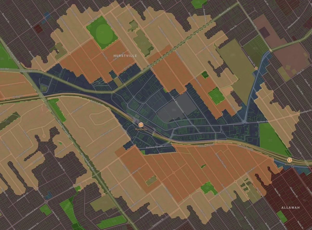
To qualify for items 2. or 3. (above) the land needs to be zoned R3 or R4 (‘medium’ and ‘high” density zones) ie. the state based controls do not overwrite pre-existing land use zones in this regard beyond what is outlined above.
Since release of the NSW Pattern Book, low-rise ‘patterns’ can be undertaken as Complying Development. These ‘patterns’ (adapted from the types otherwise defined by the NSW Low Rise Housing Diversity Code) are permitted, with lower threshold limits than would ordinarily apply by the Code (eg. 15m frontages for Terraces in lieu of the otherwise required 21 metre frontage + smaller lot sizes and half the parking), but these lower thresholds are applicable only to the LMR areas.
So, lets have a closer look to see how this might play out in Hurstville.
LMR Overlay with Land Use Zoning Overlay (Mecone Mosaic)
When we overlay Hurstville’s pre-existing R4 land use zones (orange areas - shown above); the areas surrounding the station, up to (and perhaps a little beyond) a 400m walking distance from the station, identify potential for mid-rise development. However, closer inspection of Council’s LEP shows that these areas have already been identified for similar scale development with much of it already designated for 2:1 (closer to the station) and 1.5:1 and 1:1 in the areas beyond, but this is not the clincher!
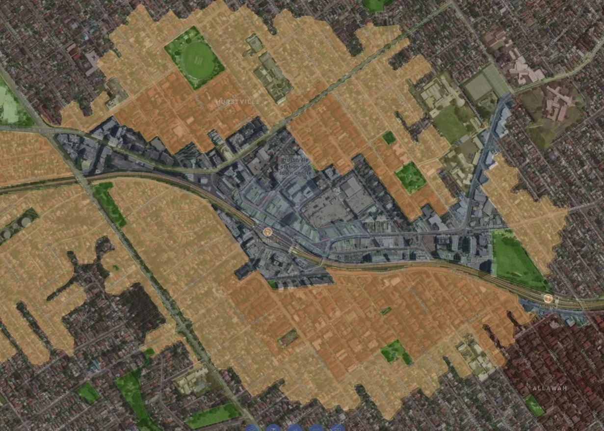
Composite LMR Overlay with Land Use Zoning Overlay (Mecone Mosaic) shown over photo (NSW Planning Portal Spatial Viewer)
If we overlay these combined planning layers over an aerial photograph (above), we can see that the R4 areas have already been expended under pre-existing planning provisions; notably, in the case of Hurstville, previous tranches of 1990’s (and earlier) walk up development. Any additional uplift (where it may be available) would not justify redevelopment via the small incremental increase in development potential.
Now, let’s try and understand the capacity for low-rise development, notably via the increased permissibility facilitated by the low-rise pattern book solutions. However, we’ll discount dual occupancy development that is already permitted within pre-existing R2 areas, and with an understanding of the following:
There are only three ‘patterns’ applicable to lots up to 15 metres wide; one is a Manor House, the second is Multi dwelling housing and the third is a Terraces proposal (identified by the NSW Pattern Book as Terraces 01). We also need to temper this with an understanding that;
The single Multi dwelling housing ‘pattern’ (where the dwellings run perpendicular to the frontage) requires deeper lots than Hurstville typically has to offer.
The Manor house, which would necessarily be strata titled, will not yield enough value to be viable as infill. Despite broader permissibility under the pre-existing Low Rise Housing Diversity Code since mid 2018, only a handful have been built; and almost none of those are as infill development. About half of those have been for Homes NSW (ie. economically subsidised for social housing)
This leaves just 1 available option to commercial developers; The Terraces 01 ‘pattern’ suitable to 15 metre lot widths, which would be applicable not only to Hurstville, but much of Sydney’s middle ring suburbs where lots exceeding 18 metres (required for the remaining 3 Terraces ‘patterns’) are rare, let alone the default 21 metre wide frontages required by the Low Rise Housing Diversity Code for these types.
A further issue is that while this specific (Terraces 01) ‘pattern’ is permitted (as 3 terraces on a single 15 metre frontage lot), no other variation is likely to be approved either via the NSW Low Rise Housing Diversity Code (for the reasons outlined above) or via regular DA application (given that Council’s DCP does not anticipate this type of development within its R2 zones).
So let’s see how this might apply to a representative piece of Hurstville…
Aerial image of the north western portion of the Hurstville LMR Area (NSW Planning Portal Spatial Viewer)
This piece of Hurstville (in the north-west quadrant of the LMR area) is representative of many suburban middle ring suburbs; constituting low rise, detached houses on individual lots. A park, which could be flanked with greater density, potentially offering great amenity for many, is reserved for the same density as the rest of the suburb.
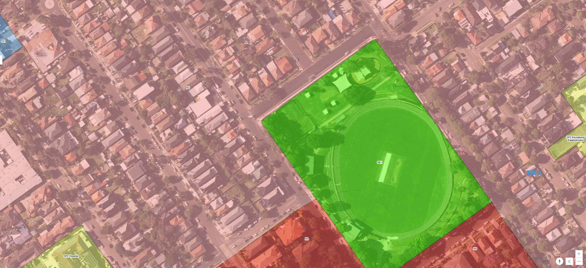
Aerial image of the north western portion with zoning layers overlay (NSW Planning Portal Spatial Viewer)
If we overlay the Local planning layers, notably;
The R4 zone (the darker red areas -above) surrounding the southern edge of the park; and,
The broader R2 zones (lighter red) making up the balance;
We can see the edge of previous tranches of development expending the pre-existing R4 zones along the southern edge of the park, and the corresponding low density areas quite literally defined by the R2 - low density zone.
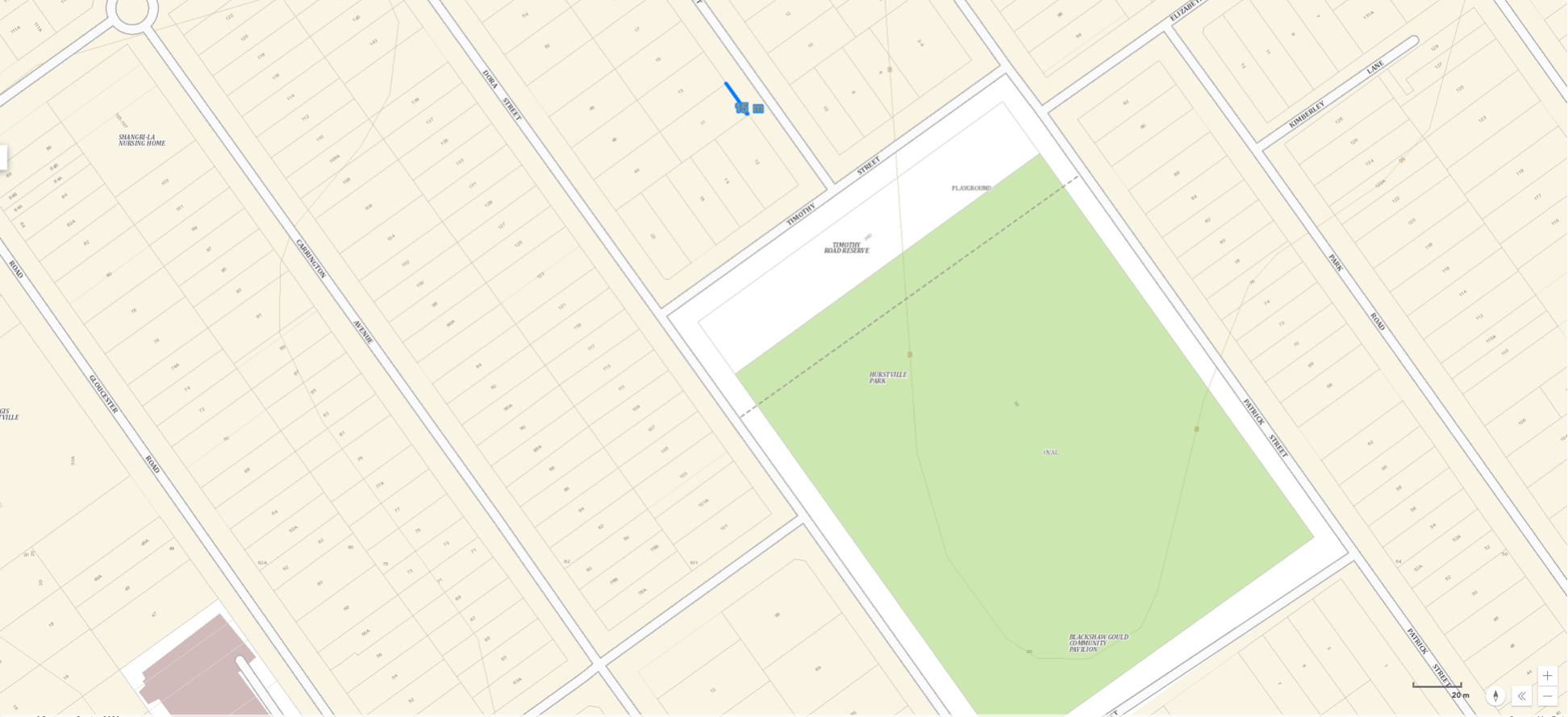
Lot / Street layout the same area with lot dimension annotated (NSW Planning Portal Spatial Viewer)
Looking more closely at the subdivision patterns and typical lot widths (above), we can see that most of the lots in this part of Hurstville range from about 10 to 15 metres (labelled above using the NSW Planning Portal Spatial Viewer’s measuring tool). The assessment of frontage dimensions allows us to plot the extent of low rise development; specifically those lots where the only available and/or viable Terrace 01 ‘pattern’ would be permitted and could be dimensionally accommodated. But, you’d have to be lucky enough not to be snookered by any pre-existing street trees which might prevent the 2 predetermined driveway crossing locations required by that ‘pattern’. The crossings will require a Council ‘Road Opening’ approval as a precondition to Complying Development approval.
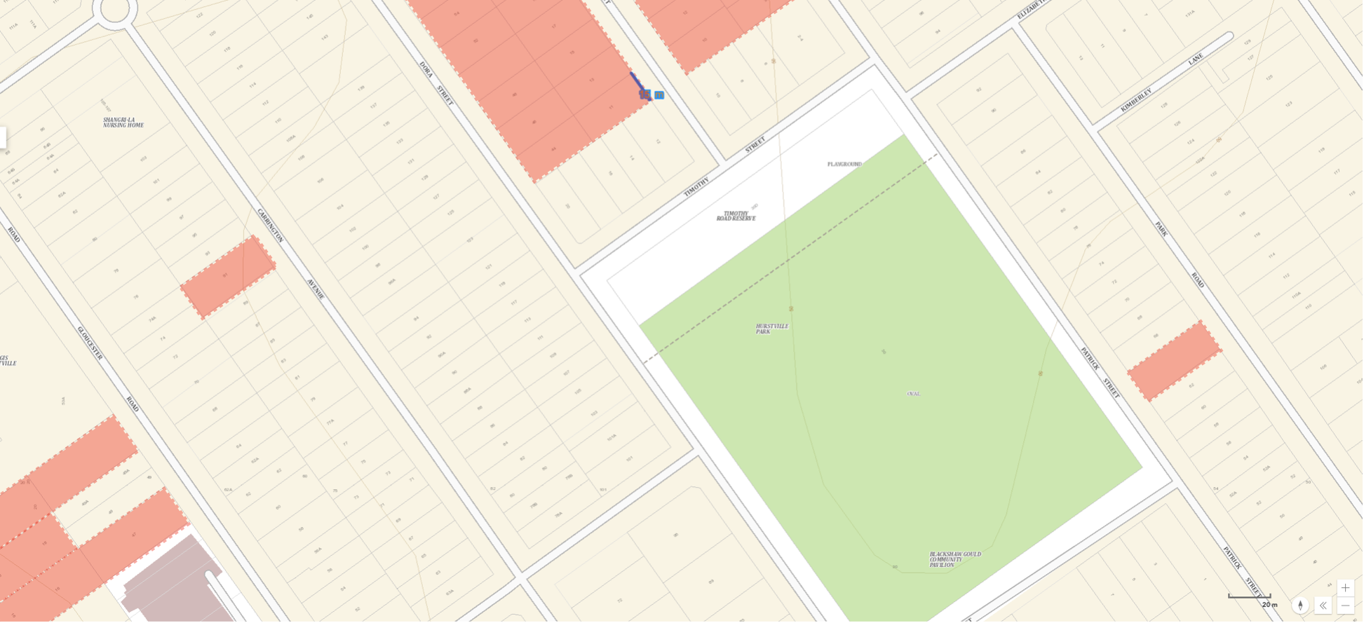
15 metre wide lots highlighted in red (NSW Planning Portal Spatial Viewer) - manual overlay.
It is only the 15 metre lots highlighted above (give or take the accuracy of the measurement tool) - about 21 lots within the image frame - that would facilitate just 42 additional dwellings ie. demolishing 21 free standing dwellings to build 63 Terraces. Furthermore, their distribution is ad-hoc; based primarily on lot frontage, and not any other broader measure of amenity (eg. the park location).
I have intentionally refrained from more critical commentary (so far) allowing the case study evidence to speak for itself.
Are these the ‘ambitious’ and transformational reforms what the doctor ordered towards providing greater capacity within our existing neighbourhoods? You be the judge!
Are there alternatives which might provide greater capacity, viability and application? And; could such strategies be sensitively, and positively integrated within planning policy to better address NIMBY backlash (seemingly a critical ingredient in any political / policy position); Absolutely! But, it will require a little more than a few screenshots from publicly available sources and the iPad I wrote this post on during a plane trip. Perhaps the NSW Department of Planning might be better resourced (insert irony here!).

